Area/code - Kevin Slavin
Territory
Workshop May 26-30 2008
Public lecture May 26 2008 at 6pm
www.playareacode.com

Press release
Comunicato stampa
Fabrica, the Benetton communication research center, continues its international workshop and lecture program. From New York, the award-winning game and media design company Area/code, co-founded by Frank Lantz and Kevin Slavin, will be at the institute from May 26th to the 30th to lead an intensive trans-disciplinary workshop. In addition, Area/code will give a public lecture on May 26th illustrating their philosophy, recent cross-media games and entertainment projects.
The workshop results will inspire a critical essay by Monika Parrinder, international design writer and co-founder of www.limitedlanguage.org Limited Language is interested in using the methods of contemporary digital practice and image making – open-source, open-ended, cut-and-paste etc. - to generate new ways of writing about communication. Monika has published articles in the design magazines, Eye, Blueprint, Print and ID. She teaches at the Royal College of Art and London College of Communication.
Area/code
Games and media define imaginary spaces that we enter into and explore. Area/code highlights the connections between these imaginary spaces and the world around them.
These connections can take many forms:
- urban environments transformed into spaces for public play
- online games that respond to broadcast TV in real time
- simulated characters and virtual worlds that occupy real-world geography
- game events driven by real-world data
- situated media that corresponds to specific locations and contexts
Area/code works with advertising agencies, media firms, networks, universities, and large consumer brands.
Clients include: Nike, Disney Imagineering, CBS, Nokia, MTV, The Discovery Channel, A&E, The History Channel, JWT, Cramer-Krasselt, Deutsch, SS+K, and the Carnegie Institute / Girls Math and Science Project.
Projects have been awarded at the Clios, the One Show, OMMA and the Future of Marketing Summit.
Area/code and its work have been covered in the Wall Street Journal, Creativity, The New York Times, Businessweek, The Chicago Tribune, MTV, Ad Age, and some of our favorite blogs including boingboing
and PSFK.
Kevin Slavin has spoken at MoMA, the Van Alen Institute, the Guardian, DLD, the Cooper Union, the Storefront for Art and Architecture, and NBC, and together with Adam Greenfield he co-teaches
"Urban Computing" at NYU/ITP. His work has been exhibited internationally, including the Design Museum of London and the Frankfurt Museum fuer Moderne Kunst.
Environmental, Social, Relational, the title of this new program of research and education activities, is rooted in Fabrica’s heritage of cross-cultural creativity for social concern. Its precise
definition however emerges directly from a recent debate between Fabrica’s researchers that had the specific objective to identify common interest platforms for future studies.
Environmental, social and relational themes are central to human ecology, an interdisciplinary field using holistic approaches in the search for harmony between people and their natural and created
environment but mainly between people and their societies.
Along these lines Fabrica wants to investigate, experiment, catalyze, document and disseminate how contemporary communication, design and artistic expression can contribute to helping people solve
problems and enhance human potential, within near and far environments.
The workshop series will bring to Fabrica international artists and designers that in common have the desire to apply creativity and innovation to social improvement.
Area/code and Fabrica’s researchers, along with a selection of external participants from the center’s global think-net, will focus the 5-day workshop on today’s environment of pervasive technologies and
overlapping media to create new concepts of relational entertainment.
Workshop brief
Territory
Joseph Beuys: “The Berlin Wall should be 5 centimeters higher, for aesthetic reasons”
You can see the walls plainly in Treviso, from the ground, from the map, from Google’s big optics. For those of you who live here, your primary forms of engagement with these walls are probably aesthetic. You might think, like Beuys, that they should be 5 centimeters higher, or 2 meters lower, or you might find the stone lovely, or the forms well articulated. But every wall has a history, and cities learn to build them from their enemies, not their friends.
Cities have always dreamed of autonomy, and walls are one material for those dreams. Designed to withstand siege and to regulate immigration and trade, city walls were built only under the “right of fortification” granted by the nation-state. City walls are the archaic hardware of national territory; the Latin for city (urbs) refers to the wall’s stones.
With city walls, the territories are defined from the inside, as a line of defense. But some walls are defined from the outside, as when Venice drew the stone lines to hard-code the Jewish Ghetto. Sometimes territory is declared by its inhabitants, and sometimes territory is declared for them.
But walls are only the most obvious boundaries. Not all territory is visible from the ground or the map or the lens of the satellite. Sometimes there are only traces, one needs to learn how to read them. We’ll look at cases in which a thin roll of wire is enough, in the American West and in cities around the world. Sometimes it’s even thinner than a wire, maybe just a sticker, maybe just the layer of paint that marks gang turf. And sometimes it’s invisible altogether. A lot of territory exists only in the air or in the mind.
The territory in the air reflects the overall shift from the power of the visible (like a wall) to the power of the invisible (like a firewall). Consider the practice of “pirate radio” in which a signal is legal to transmit on one side of a border, but illegal to receive on the other. Radio waves have a territory all their own, with boundaries that are real but invisible, unconcerned with the lines on the map. Sometimes the invisible territories conform to geography (as a Chinese Google search will reveal) but more frequently they don’t.
When the Roman Empire expanded and congealed into cities, they were always based on a grid, always the same grid, always aligned to the very same compass points. The gridded cities embodied the endless terrain of the empire, even if the space between the cities was unarticulated. Some 2,000 years later, however, Roman citizens were panicked by a camera-equipped “Google Car” as it passively mapped the streets for Google StreetView. It’s one thing to impose an endless grid upon the world, and another thing to have a grid imposed upon you, even when the grid is invisible. Especially when it’s invisible. Territory is like this: you don’t have to see it to know it’s there.
For many of us, our first group social experiences were children’s street games. Red Rover. British Bulldog, Kick the Can, “Red Light, Green Light”. There was a lot to learn from these games: teams are arbitrary, and not, victory is random, and not, and it’s fun and games, and not. Beyond all that, however, these games are built around temporary “consensual hallucinations” in which we all agree that this is the center of the world, this is one side or the other, this is the goal, this is the jail. When the game is over, the territories revert back to whatever they were, a schoolyard, a basement, the sidewalk. Our early experiments in group socialization are built around imagining territory and then agreeing on its real-world boundaries, which will live on earth only as long as we imagine them.
In the end, most of the territory on earth lives only there, as the mental images in the minds of its citizens. When Korzybski first coined the phrase “The Map is not the Territory” in 1931, he was referring to the cognitive error of believing our abstractions of the world to be the world itself, mistaking the word for the thing. Territory seems to start with stone walls, but it starts with the plans for those walls, and it starts before those plans with the belief that the lines of that plan are meaningful. Territory really starts with someone reading those lines on the earth, or with writing them.
With 195 countries and 6.5 billion people, there’s more territory on earth than there’s ever been. In and around Treviso, we will find us some, learn how to read it, learn how to write it, how to work it through and play it out. We can write it with our minds and with the media at hand, material & immaterial. And just as surely, we can re-write it, with the same minds and the same media. For a few days, let’s read, write and revise Treviso, change the maps, change the territory.
Three steps.
- You will break up into small groups or individuals to identify the territory. Splitting up, you will spend some hours in Treviso looking for territory that is poorly defined, undefined, invisible, suppressed, forgotten, or otherwise somehow imperceptible to most everyone.
- Design an intervention around that territory. Demarcate, delineate, render, make visible. Foucault spoke of the “liminal horizon.” Bring the territory into some form of cognitive focus.
- Bring that intervention to life in such a way that is mostly legal, mostly impermanent, modest, sincere, funny, serious. Lenin issued a Soviet mandate that public monuments must be constructed as temporary. For this, they embalmed his body forever. And yet he was right.
Meanwhile.
Meanwhile, during the workshop, we’ll be playing “GoCrossCampus” which is an online game played using the map of the Fabrica campus. You will be divided into teams, and the winning team will prove that winning matters, and that the campus itself can be won and lost a thousand different ways.
|

Kevin Slavin
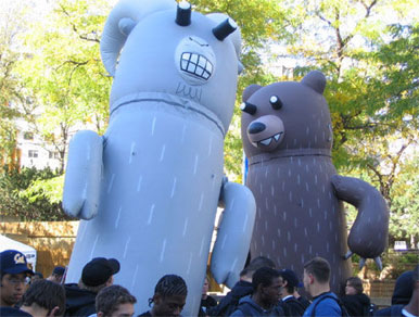
ConQwest (2004-2005) -- Qwest
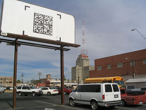
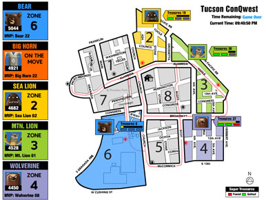
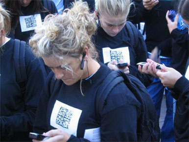
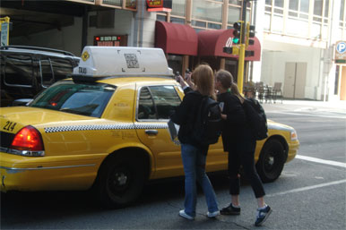
Big Game in 10 cities across the United States.
First use of semacode in North America. Includes also 20’ inflatable animals, 1000 high school students, real-time visualizations of the players in action.
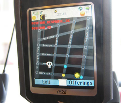
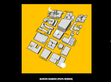
Crossroads (2006) – Van Alen Institute
2-player mobile phone location-based game for “The Good Life” exhibition at the Van Alen Institute. Two players compete to capture intersections in New York City by running through the streets. They must also avoid Papa Bones, an invisible spirit who pursues them through physical space.
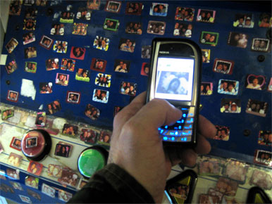
SuperStar Tokyo (2005)
Mobile game uses optical-recognition technology to recognize Puri Kura stickers
in a distributed urban game through Tokyo. Players get points for seeing the
stickers of other players, as well as by being seen.
Sharkrunners (2007) – Discovery Channel
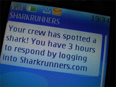
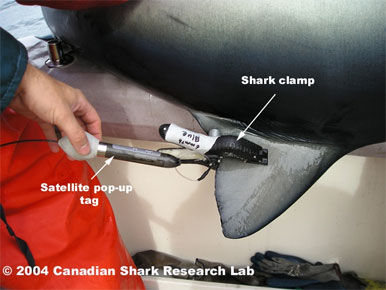
Real-time flash based videogame in which players become marine biologists looking for sharks, in order to study them. The game runs in real time, so players are alerted to “shark encounters” by receiving SMS texts. In addition, the ships are controlled by the players, and the sharks are controlled by real sharks that have GPS receivers stapled to their dorsal fins.

Sopranos Connection (2006) – A&E
First ever game to synchronize between a live television broadcast (the Sopranos, on A&E) and a videogame in the browser. Depending on the players moves, and the events that happen in the real broadcast of the Sopranos, the board comes to life and scores points for players.
Parking Wars (2007-2008) – A&E
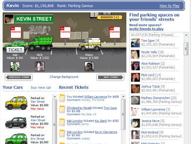
“Social game” for A&E on Facebook in which users “park” on other players pages, and ticket players who have parked illegally. Over 500,000 players in 2 months have produced over 200MM page views.

Chain Factor ARG (2007) – CBS
Alternate Reality Game for the show “Numb3rs” on CBS. Worked directly with show writers to construct the episode, and the real world that it extended into.
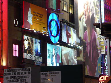
Images here are of the real-world media that contain secret messages embedded in the game system.
|



